| arts |
| william morris |
| theatre in the valley |
| magic in murals |
| woodworking |
| living |
| water gardens |
| recreation |
| summer trail picks |
| sun valley from a to z |
| dining |
| pure gourmet idaho |
| black pot magic |
| calendar |
| summer 2001 |
| maps (large) |
| heart of idaho |
| hike & bike trails |
| ketchum & sun valley |
| KART bus routes |
| the guide |
| front page |
| back issues |
| advertising info |
| about |
| Produced
& Maintained by Express Publishing, Box 1013, Ketchum, ID 83340-1013 208.726.0719 Voice 208.726.2329 Fax info@svguide.com |
|
Copyright
© 2001 Express Publishing Inc. |
|
The Sun Valley Guide is distributed free twice yearly to residents and guests throughout the Sun Valley, Idaho resort area community. Subscribers to the Idaho Mountain Express will receive the Sun Valley Guide inserted into the paid edition of the newspaper. |

![]()
| local listings |
| art galleries |
| equipment rentals |
| outfitters & guides |
| fitness centers |
| golf courses |
| tennis courts |
| property management |
| lodging |
| restaurants |


summer 2001 : maps : trail maps
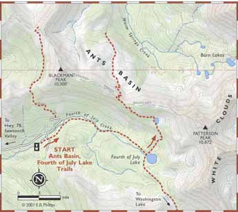
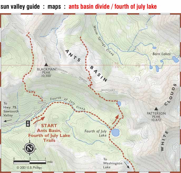
ants basin divide and
fourth of july lake trailsclick on map to see full size version.
map ©2001 E.B. Phillips. map background ©2000 National Geographic, from the "Topo" Idaho CD-ROM series. Reprinted with permission.
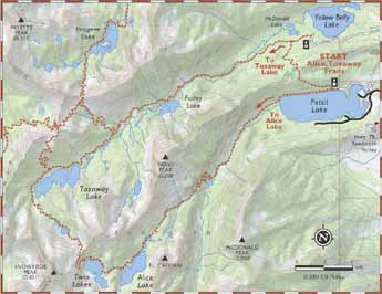
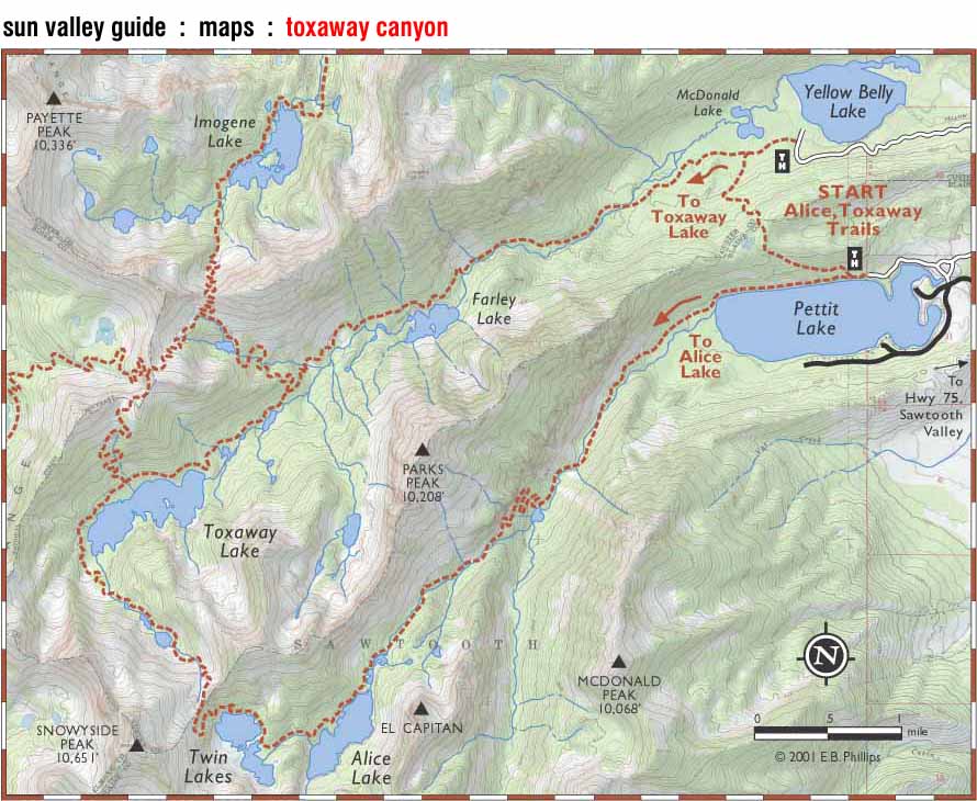
toxaway canyon trails
click on map to see full size version.
map ©2001 E.B. Phillips. map background ©2000 National Geographic, from the "Topo" Idaho CD-ROM series. Reprinted with permission.
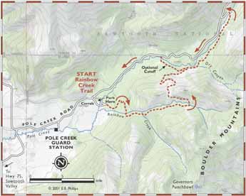
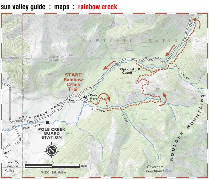
rainbow creek trail
click on map to see full size version.
map ©2001 E.B. Phillips. map background ©2000 National Geographic, from the "Topo" Idaho CD-ROM series. Reprinted with permission.
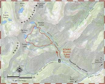
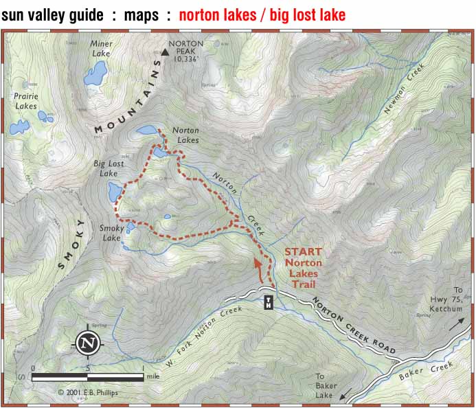
norton lakes and
big lost lake trailclick on map to see full size version.
map ©2001 E.B. Phillips. map background ©2000 National Geographic, from the "Topo" Idaho CD-ROM series. Reprinted with permission.
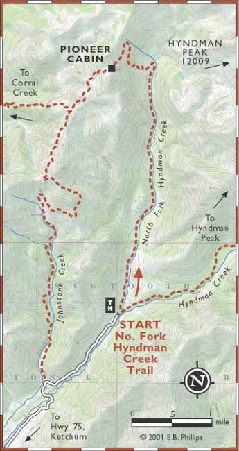
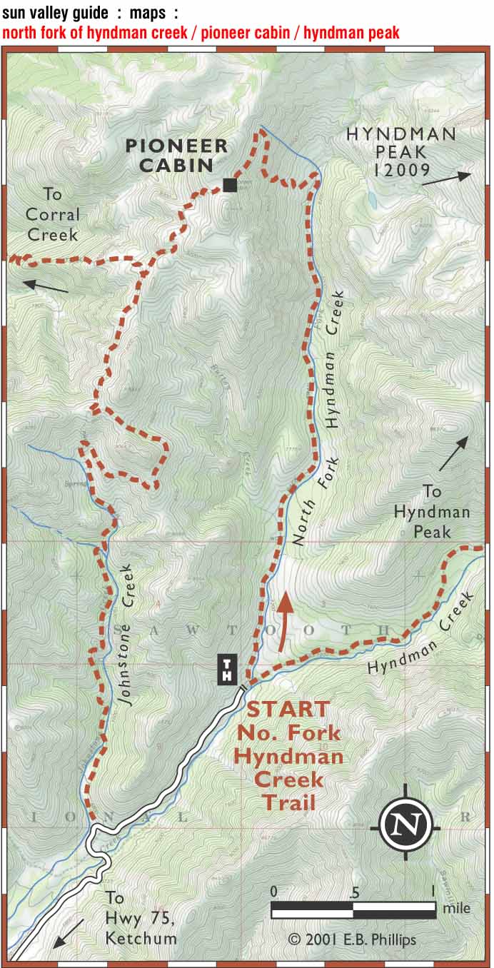
north fork of hyndman creek, the pioneer cabin trails and hyndman peak
click on map to see full size version.
map ©2001 E.B. Phillips. map background ©2000 National Geographic, from the "Topo" Idaho CD-ROM series. Reprinted with permission.