|
|


|
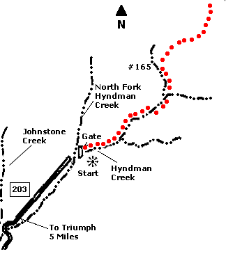
 Map |
 |
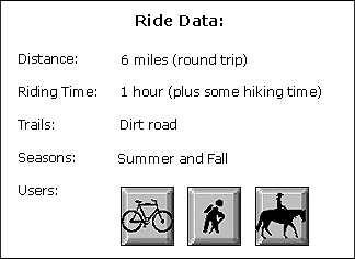
 Summary |
| ABOUT
THE RIDE: This is a "hike and
bike" trail that leads to a beautiful basin
in the rugged Pioneer Mountains. All of the
riding is on an easy, uphill dirt road. For added
distance, you can park your car in Triumph and
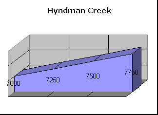
ride from there. GETTING THERE: Drive five miles south from Ketchum on State Highway 75 and turn (east) onto East Fork Road. Drive six miles east (one and one half miles past Triumph), then make a hard left turn up a hill at the sign which says "North Fork of Hyndman Creek". Drive another three miles to the first stream crossing where Johnstone Creek and other creeks come together. Cross Hyndman Creek, then continue on the dirt road to the north side of the creek for one and one quarter miles until you come to a road closure sign and gate. Park your car in the meadow THE RIDE: Cross to the other side of the creek, then follow the dirt road on the north side of the stream. Keep riding for three miles. In the springtime some areas may be boggy. Walk your bike through these areas to prevent trail damage. Near the end of the road, you will come to a steep hillside. Hide or lock you bike here, then continue hiking up the hill. At the top of the hill, cross the creek then continue up a trail to the Hyndman Basin. You might want to try climbing 12,008' Hyndman Peak, one of Idaho's highest. Return the same way. |
|
© 1997 JHL
& Associates, all rights reserved ~ Produced
by JHL & Associates |