|
|


|
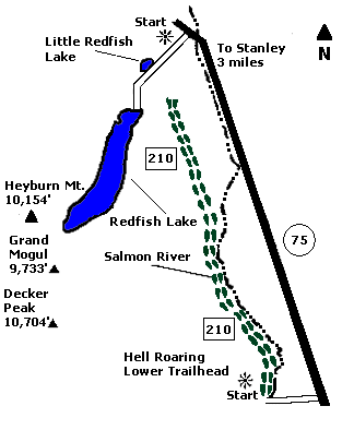
 Map |
 |
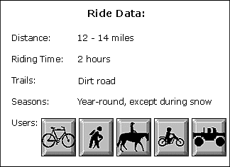
 Summary |
| ABOUT
THE RIDE: Decker Flat, named after an
early-day miner who homesteaded in the area, is a
popular ride for the whole family. The easy
riding on a dirt road, the lupine's fragrance,
and scenic vistas make this an enjoyable ride for
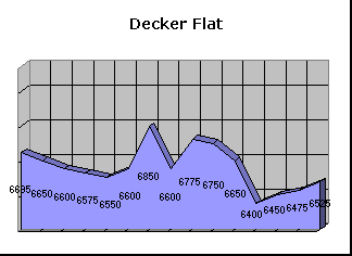
all. GETTING THERE: Drive 45.5 miles north on State Highway 75 to the Hell Roaring Creek Trailhead on the west side of the highway. If you are doing this as a one-way trip leave another vehicle at Redfish Lake. THE RIDE: From the Hell Roaring Trailhead, ride north, keeping to the right side of an irrigation ditch. It's a slight downhill grade. Stay to the right (bordering the Salmon River), and you'll ride through a sagebrush flat. Wildflowers are in full bloom in this area during mid-July. At 5.5 miles, make a sharp left at the fork of two roads. The road quality deteriorates. For the next six miles, the ride rolls up and down near a lodgepole forest with occasional eastern views. There are many shady areas to rest. Bring water. The road ends at the Redfish Lake access road. Turn left (south) onto the paved road, and follow it to Redfish Lake, one of the Sawtooth's most scenic lakes. There is a lodge, store, and restaurant here. ALTERNATE ROUTE: Ride back to the Hell Roaring Trailhead, or leave a car at the intersection of State Highway 75 and Redfish Lake Road. |
|
© 1997 JHL
& Associates, all rights reserved ~ Produced
by JHL & Associates |